History of our achievements
BACKGROUND OF THE WOLLI CREEK PRESERVATION SOCIETY
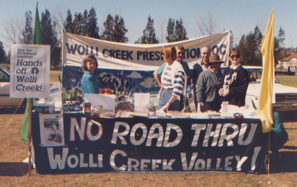
The Wolli Creek Preservation Society (WCPS) was originally formed in 1983 to actively oppose the construction of the M5 East motorway through the Wolli Creek Valley. It was incorporated in 1987. Over the decades, the valley has faced some dire planning proposals, particularly the proposal for an eight-lane surface motorway through almost the whole of the Valley’s bushland. This proposal was defeated, but WCPS members have had to fight hard to retain and to restore the bushland. There is still a way to go in restoring its bushland but bringing the bulk of the valley’s bushland under the protection afforded by Regional Park status is a step in the right direction, enabling unified management decisions to be made.


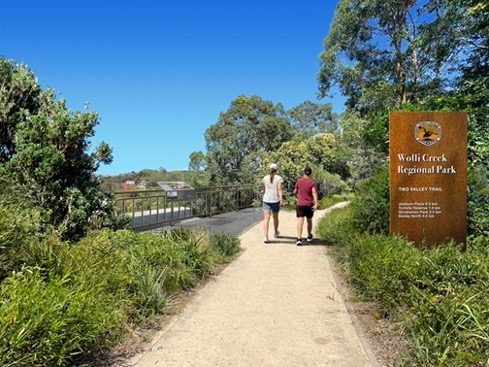
WCPS, having campaigned hard to prevent the surface motorway, worked tirelessly to promote awareness of the natural values of the valley as the largest area of near-natural bushland in inner south-west Sydney. This awareness was essential to gaining wide public support for its retention. Many activities, including guided walks and the establishment of the Two Valley Trail (along the Wolli Creek and Cooks River Valleys), were aimed at this. Talks were organised for members and the public to highlight specific aspects of the flora and fauna. Presentations were made to interested community groups, and bushcare groups were established to allow clear demonstration of community commitment to preservation and restoration of the bushland.
SAVING THE VALLEY
WCPS was formed in 1983 to fight to save the valley’s bushland and has campaigned ever since to achieve this.
Regional Park campaigns
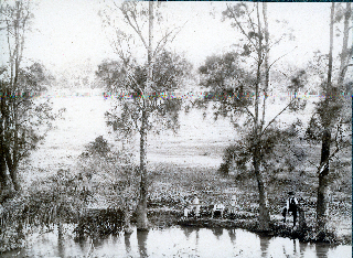
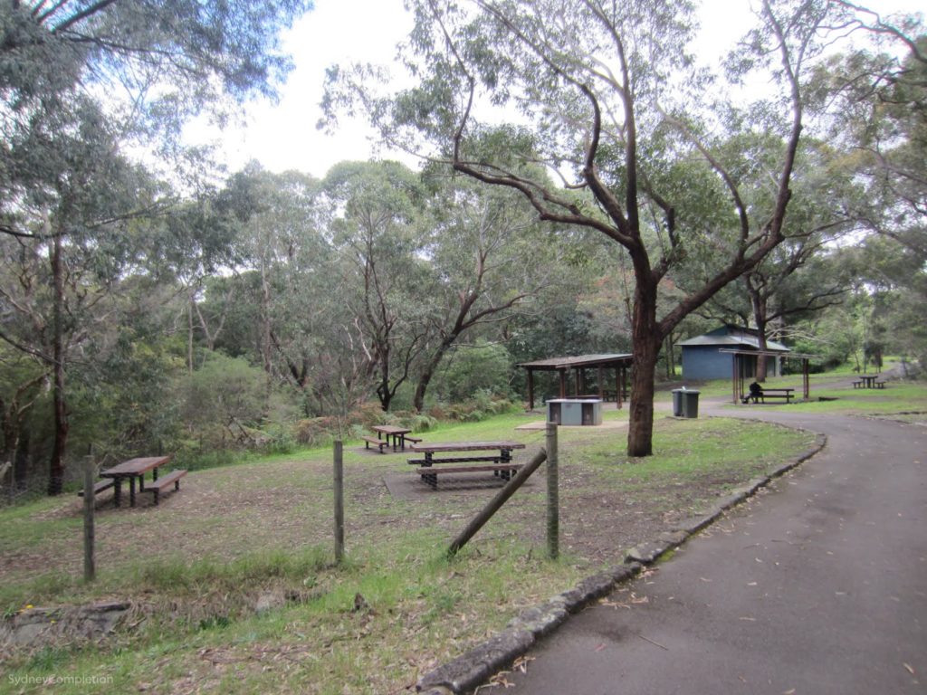
Much of the Wolli Creek Valley’s extensive areas of bushland are of significant conservation value, given its inner-urban location. The bushland supports a great diversity of flora and fauna, in multiple ecosystems and provides many passive recreational opportunities for visitors. Wolli Creek is one of the few remaining creeks in inner Sydney that has retained much of its natural banks. Due largely to community effort the area has survived, and is an essential part of the region’s natural heritage.
How has it survived? The Wolli Valley was saved from most building development in the colony’s early days by its rugged terrain and by being away from the main transport routes associated with southern Sydney’s expansion. This mostly followed railway lines, over the location of which there was much politicking and probable corruption.
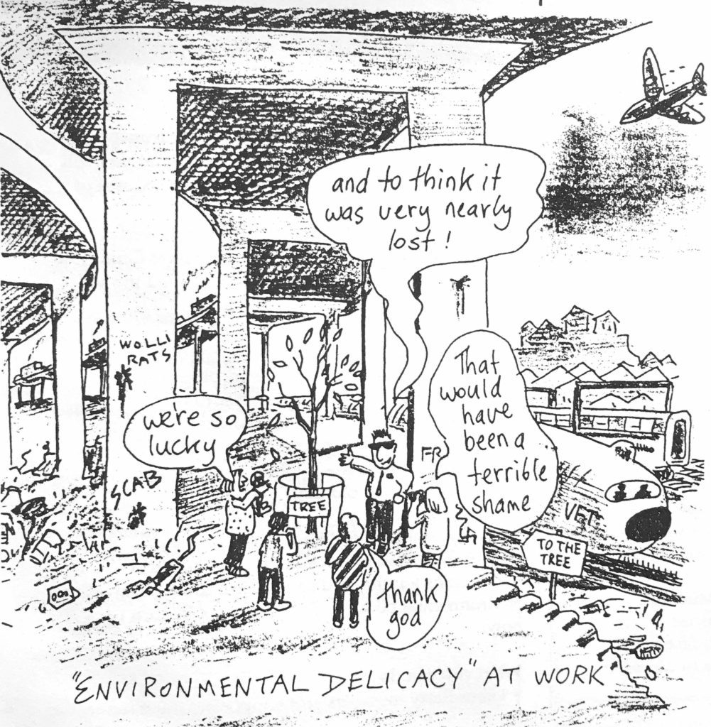
From 1948, the Valley was preserved but neglected because of a major road reservation under the County of Cumberland Plan (developed in 1948 and gazetted in 1951) This was eventually known as the M5 East corridor. 1978 saw a NSW government road proposal for an eight-lane motorway as a surface road from Redfern to Liverpool via the Wolli Valley.
This was delayed for many years due to the negative findings of the government’s Kirby Inquiry into the proposed Kyeemagh to Chullora freight road, which recommended the preservation of the Wolli Creek bushland. Strong community objections, encouraged by the Inquiry’s report (1980) led to the formation of the Wolli Creek Preservation Society in 1983. The Society kept up a determined campaign against a motorway through the Valley (for more on this see below).
In 1988 the then Minister for the Environment, Tim Moore, announced that, with the lifting of a road reservation, the bushland areas of the valley were “now guaranteed permanent preservation”, but they were only protected by Open Space zoning.
In an effort to achieve greater protection for the Wolli Creek bushland, WCPS called for the creation of a Wolli Creek Bush Park. Following a long campaign, in 1993/4 WCPS worked with Clover Moore, then the State member for Sydney, who introduced a Bill aimed at creating a Wolli Creek Park Trust to hold the lands. But Parliament was prorogued before the Bill could be debated and it didn’t resurface. But there was now a new form of protection potentially available: a Regional Park under National Parks and Wildlife Service management.
Campaigning against motorway destruction of the Valley’s bushland continued and in 1998, following the adoption of a tunnel solution for the M5East, the then Labor Government announced the prospective establishment of a 60-hectare Wolli Creek Regional Park. The government’s proposal did not include the creek itself, nor its southern bank. In 1999 the NSW Government announced that the M5 East would go underground as a tunnel under Arncliffe. The M5 East tunnel opened in 2002 and the formation of this Regional Park seemed imminent.
The Regional Park finally began to take shape in 2003 when NPWS acquired the 8.9 ha of Girrahween Park, below the Earlwood shopping centre. But despite WCPS pressure, it was not until 2004 that the then Minister of the Environment signed off on a Plan of Management and Masterplan for the Regional Park, essentially the same as the draft plan prepared four years earlier, and just in time for a public meeting called by WCPS..
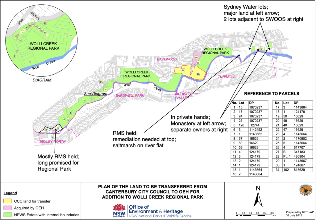
Campaigning to accelerate progress on park formation continued but the Regional Park made very slow progress, in part because of the complexities of land ownership. Over 100 different lots, some of them in private hands, were within the park boundaries. Some required subdivision before transfer, one had sensitive Sydney Water infrastructure within it and one had significant contamination. And, of course, additional resources were needed to undertake extensive surveying, mapping and negotiation with the various owners.
But there was not much evidence of action in the ensuing two years, until another public meeting was called by WCPS in 2006. “Where’s Our Regional Park?” we asked. All public owners seemed to indicate that there were no barriers to the transfer of lands to the NPWS
A generally positive and constructive meeting ended with strong expectations and some acknowledged problems: agreements had to be reached between (the then) Department of Environment and Conservation, Sydney Water, the Department of Planning, and Canterbury City Council to allow essential rezonings. and the RTA road reservation over the valley had to be lifted. Excitingly, there was the promise of the addition of Wolli Bluff at Undercliffe at the eastern gateway to the Regional Park lands.
There was then a period of very effective co-operation and support for the bushland of the park among the various State agencies, the City of Canterbury, and WCPS. Major improvements occurred and more were in the pipeline. In 2008, WCPS signed its first Memorandum of Understanding with NPWS to set the parameters for ongoing co-operation.
It was 2010 before 50% of the land proposed for the park had been acquired by NPWS. A campaign in 2010 resulted in 3,200 signatures. These were unrolled from a drum in the city, at an event calling on the Government to honour the 1998 commitment to complete the park. WCPS was convinced that, until all 50 hectares of the Wolli Creek Valley bushland were under the control of NPWS as a complete Wolli Creek Regional Park, it wouldn’t be safe enough from development and damage. Subsequent experience bore this out. It was recognised that, even then, continued vigilance would be needed as NPWS land can be taken back through Parliamentary legislation.

But, while cooperation between WCPS and NPWS continued, the period from 2014 was marked by reduced funding for NPWS and even slower progress on the needed land transfers. Acquisition of lands by the State Government continued at a snail’s pace but transfers of land already State-owned to NPWS was even slower.
Threats to the bushland have continued:
- The effective destruction of the western end of the Regional Park was envisaged in the early design stages (2009) of the massive WestConnex project (for more info see below).
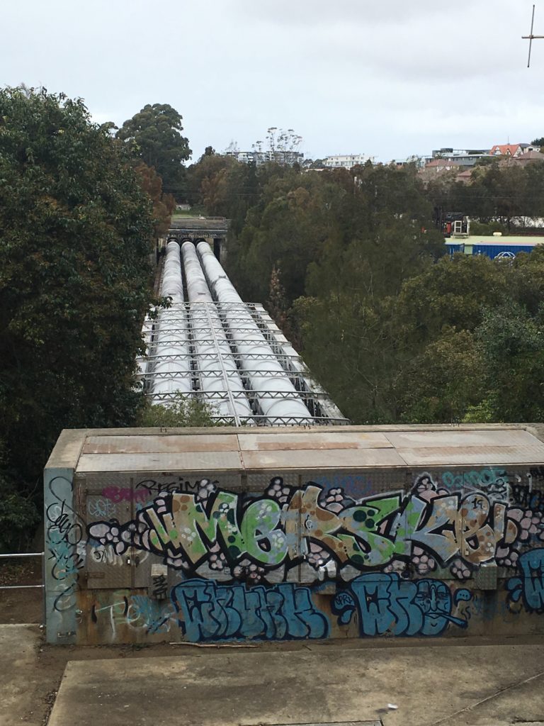
- The installation of a significant industrial plant (an Odour Control Unit, OCU) within the eastern end of the Regional Park was proposed by Sydney Water in 2017. This would have broken the connectivity of the park’s bushland and destroyed a lot of it during construction. The outcome was unresolved at June 2023. For more detail see below.
- In 2022, Sydney Water contractors cut a wide swathe through part of the western gateway land to reach a sewer access shaft. A Wolli Creek Preservation Society bush regeneration site was also impacted.
- in 2023, a private owner dumped large amounts of fill onto land reserved as Open Space and part of the identified Regional Park lands, and heavily impacted another WCPS bush regeneration site.
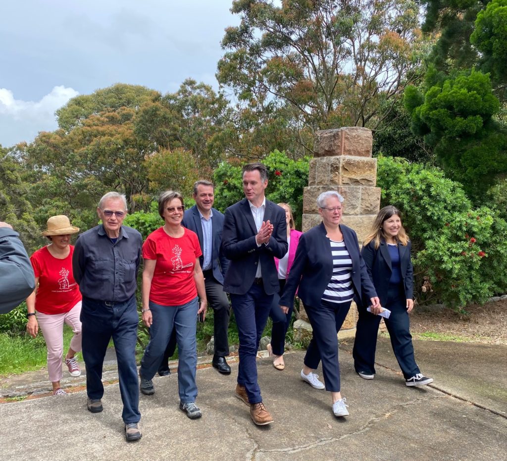
In 2022, with the OCU in the Wolli Valley now seeming unlikely, WCPS returned again to campaigning for the completion of the Wolli Creek Regional Park. The Regional Park was still not complete in June 2023, a whole generation after the commitments to it were made. The good news was that the incoming Minns government had made a campaign commitment to Regional Park completion.
That commitment was followed up with the allocation of $13 million in the September 2023 state budget to complete the park. In March 2024, a further 5 hectares were transferred into the control of NPWS as managers of the Wolli Creek Regional Park. Acquisition of the remaining lands, owned by Sydney Water and private landholders, was still being negotiated at June 2024.
Key campaigns and issues that the WCPS has been involved in to protect the bushland or complete the Regional Park include:
M5 East Campaign
With the two major parties opposing a multi-lane motorway through Wolli when in opposition and supporting it when in office, the WCPS kept up a determined campaign against it.
An ALP campaign commitment in 1998 announced the prospective establishment of the Wolli Creek Regional Park, and in 1999 the NSW Government announced that the M5 East would go underground in a tunnel under Arncliffe. The M5 East tunnel opened in 2002, slightly south of Wolli Creek, mostly under Bardwell Park and Arncliffe. However, some small patches of bushland between Bexley North and Kingsgrove were lost to the above ground section of what was now a tolled motorway. The important and distinctive bushland at Beverly Grove, Kingsgrove, further west, was to be retained.
For an extensive account of the battle to save the Wolli Valley from this motorway development see ‘Saving Wolli Creek – the complete documentary’.
New M5/WestConnex Campaign
In 2009 WCPS became aware of plans by the then Roads and Traffic Authority (RTA) to use land at the western end of the Regional Park at Bexley Rd, its western gateway, for the site of a tunnel entrance as part of the development of the New M5, itself part of the vast WestConnex project. This RTA-owned bushland had been promised by the RTA to become part of the Regional Park.
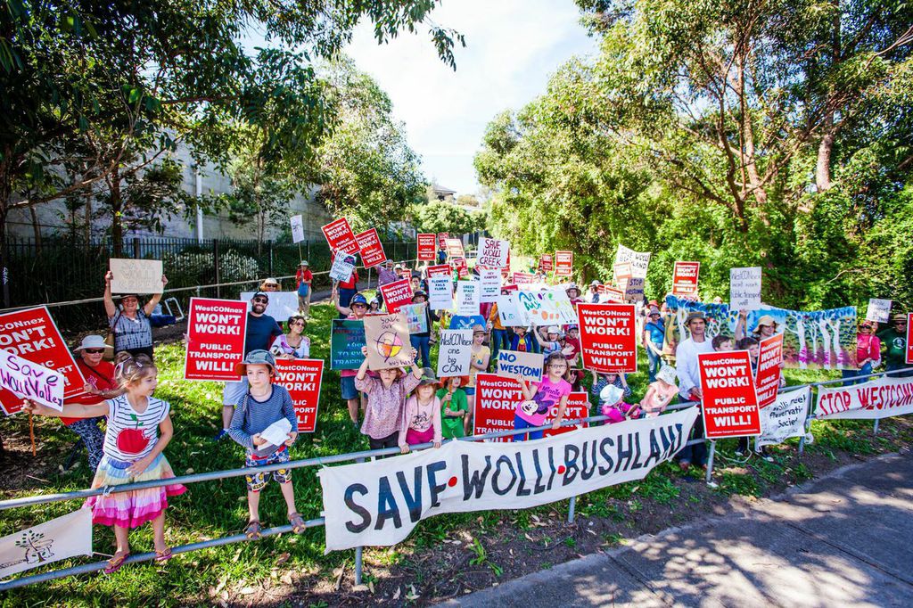
WCPS campaigned against WestConnex, joining with other motorway opponents and running major on-site events for the public to show what would be lost in Wolli. Hug-a-Tree Day (2012), Inspired by Wolli (2013), Tree-mendous Wolli (2014). In December 2016, with a change in the nature of the route of the New M5, the Government finally agreed to have this western gateway land transferred to NPWS to be added to the Wolli Creek Regional Park.
However, there was a substantial downside to this. With the tunnel entrance now further west, the Beverly Grove bushland, thought to have been protected as a consent condition for the earlier M5East, was effectively destroyed for a slip road and worksite. The alleged ‘offset’ for this took many years to find and was farcical, and giving credits for bushland not actually under threat.
The transfer of the western gateway land to NPWS had not been completed prior to the March 2023 State election, when completion of the Regional Park was a campaign commitment by the incoming government.
Some of the media coverage of this campaign can be viewed here:
A cycleway route
The long-standing issue of a cycle route through the Wolli Creek Valley is left over from the consent conditions imposed on the RTA for the original M5E. It is a ‘missing link’ in cycleway networks and is about having a direct route between Bexley North and Wolli Creek (the suburb). WCPS has supported the need for such a link, but has opposed all the actual proposals put forward by the RTA and successors, while offering alternatives that preserve the regionally significant Wolli bushland.
Over the past 20 years several proposals for providing this link have been made:
- a route through what is now the Wolli Creek Regional Park (several variations), made by the RTA and involving a cycleway through sensitive riparian environments and endangered ecological communities, with sections actually constructed in and over the top of creek.
- a route using the northern side of the rail corridor, strongly resisted by Rail authorities and with numerous technical difficulties including a bottle neck around Turrella station. This route would have passed through an area now used by the Grey-headed Flying-fox camp. It closely corresponds to a route revived in the 2023 Bayside Council Bike Plan.
- a route using the southern side of the rail corridor, again resisted by Rail authorities.
- the route eventually implemented by the RTA, which took cyclists down Cup and Saucer Creek to the Cooks River cycleway corridor.
- an on-road route proposed by a group of cyclists (Pathfinders, in 2002) with which WCPS worked, involving Slade Road and Darley Road, both of which have since become very busy.
- a mixed on-road and separated route proposed by WCPS in response to the Bayside Council Bike Plan and mapped and explained here.
There are a number of problems with any cycleway using the rail corridor:
- a highly restricted number of suitable access points, essentially at the stations.
- the long stretches of cycleway in which individuals are isolated from help if accosted or injured.
- the need for extensive, high fencing to ensure rail line security.
- on the northern side, the proximity to a watercourse, and the impact of lighting on wildlife in the Wolli Creek Regional Park.
- the usefulness to only one of six identifiable groups of bike users.
There are several issues faced by all candidate routes and none are perfect:
- The principal problem faced by any route from the RTA’s Linear Park at Bexley Road to Wolli Creek (the suburb) is that at some point the cycleway has to cross both Wolli Creek and the Airport rail line. There are only 3 serious prospects:
- Bexley Road (extremely busy, but it might be possible to incorporate a separated path into any action to raise the bridge over Wolli Creek. However, the route from there on is problematic as Slade Road is busy and narrow).
- Bardwell Park, where there is a busy road to cross and a narrow bridge over the creek to negotiate.
- The Henderson St footbridge at Turrella Reserve, which is already a cycleway, but accessing this from the west without impacting bushland requires the use of at least some sections of the very busy Homer St through Earlwood.
There are technical problems with each of the routes with cost consequences as well as safety, special and environmental aspects.
Any proposal now also has to deal with new issues created by the growing use of electrified bikes and scooters. This has implications both for the promotion of cycling as an ‘active’ form of transport and for the safety of other users of cycleways, particularly where pedestrians share the same path.
The latest WCPS proposal itself has technical problems to overcome but being mainly on-road only in back streets and in separated corridors elsewhere, is reasonably safe for cyclists, has many access points and relatively few environmental issues.
Odour Control Unit (OCU) Campaign
Following the saving of the western gateway land from destruction by WestConnex, WCPS turned its attention back to gaining the completion of the Regional Park as a whole. In July 2017, WCPS wrote to the Minister for Water seeking transfer of Sydney Water land in the Wolli Creek Valley to the Regional Park. Just after this letter, perhaps in response to it, it became evident that Sydney Water was proposing to retain some of this land for an Odour Control Unit (OCU). Its proposed location would install a significant industrial plant within the bounds of the Regional Park and break the connectivity of the bushland. The process of construction would have been very destructive of the bushland.

During ensuing consultations with Sydney Water from late 2018 to March 2022, WCPS put up two alternative proposals for locating the OCU. It accepted the reasons for the rejection of the first, but pressed strongly for the second, which put the OCU just outside the Regional Park.
WCPS ran an extensive campaign including lobbying Government Ministers and local MPs, gaining motions of support from local Councils, producing media releases and a Sydney Morning Herald interview, videoing some ‘street theatre’, and achieving support from environmental and heritage groups, plus a widely promoted petition to the Minister for Water. The petition received over 5,000 signatures.
In March 2022, probably as a result of the campaign, WCPS was informed that the whole project was ‘put on hold’ on technical grounds, while a potential new location outside the Wolli Valley was investigated. New information about toxic gases in the local sewer system meant that an extra element would be needed at the OCU and all the sites in the valley were space-constrained and probably couldn’t fit it in without a cost blow-out and more extensive destruction of bushland.
It seems that without the delays occasioned by WCPS arguments, counterproposals, and questions, backed by the support of the 5,000 signatories on our petition, the OCU might have been built by 2023, only to be found ‘not fit for purpose’ with all sorts of costly consequences.
The odour and corrosion problems that the OCU was to solve remained, along with the new problem of toxic gases. So it was clear that, in principle at least, the OCU had not completely gone away, but only put on hold for 6-8 months, ie until Sept-Nov 2022. In mid-August 2023, WCPS received an email that told us that the “Unwin Street OCU has been closed out as a delivery project.” The threat appears to be over, but vigilance is the watchword because in mid-September 2023 we were still awaiting more formal confirmation. Sydney Water was still proposing to hold on to part of the land for the OCU, with consequences for the completion of Wolli Creek Regional Park.
Watch footage of some of the campaign undertaken by WCPS
See also Campaigns & Issues.
PROTECTING AND ENHANCING THE VALLEY
WCPS has been involved in many projects and activities that have resulted in the enhancement of the valley. Here are some of them:
Partnership with National Parks and Wildlife Service
In 2008, the Society signed a Memorandum of Understanding with NPWS to set the parameters for ongoing co-operation. This includes agreements around the WCPS undertaking bushcare and activities in the Regional Park and commitments from NPWS about their responsibilities within this agreement. This agreement was most recently updated in 2023 and has provided the background for frequent contact and discussion on Regional Park issues.
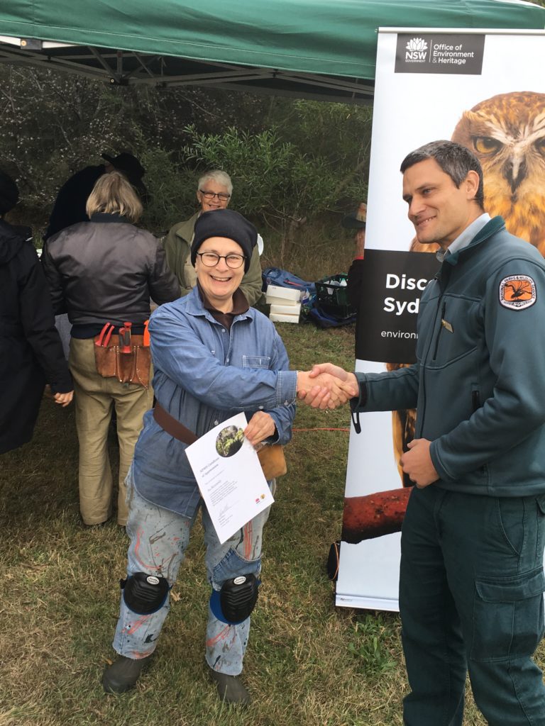
Bushcare work and grants
There are currently six bushcare sites that WCPS has set up to restore and maintain the valley’s bushland.
- 1997 – First site at Girrawheen Park (reported in the Update July 1999) (no longer active)
- 2003 – Bray Ave site began with support from the EPB RSL, including a small grant for tools,
- 2006 – Johnston Street bush site began following planting along Johnston St under a grant
- 2007 – Paperbark Creek began after storm water earthworks undertaken by Council
- 2008 – Undercliffe and the Bluff bushcare sites began.
- 2011 – WCPS initiated a group at Stotts Reserve on the southern side of the creek, taken over by Rockdale Council in 2013
- 2022 – Turrella Reserve bushcare site began
To support its volunteer bush regeneration activities, WCPS has successfully obtained and administered grants from a number of sources, mainly Local, State and Federal Governments, but also through Landcare, corporations, and a local RSL. Additional volunteer labour has been provided by employees on ‘corporate days’ and by the local community for things like planting days.
Since 2003, grants totalling $0.5m (in 2023 dollars) have been received. Under these grants, and latterly using WCPS own funds, professional bush regeneration teams have been contracted to undertake work in support of volunteer efforts.
Stormwater Management
Improvements to the bush and creek have involved controlling and treating stormwater run–off from surrounding streets. In the past, such stormwater coming from many street drains was often channelled in pipes to the nearest bushland and that’s where the pipes ended. This strong flow then spread out, eroded some areas, built up silt and rubbish elsewhere and brought many nutrients and weed materials into the bush. As a result, most water channels below the outlets were a tangled mess of rubbish and many weeds.

Stormwater Improvement actions within the valley resulting from pressure by WCPS have included:
- 2006 Bray Avenue – Restructuring of a short channel into the billabong wetland under joint funding from Canterbury Council and the State Government’s Cooks River Foreshore Improvement Plan. In 2009, a Gross Pollutant Trap (GPT) was installed above the restructured channel.
- 2007 Paperbark Creek – restructuring of the initial creekline below the outlet (taken down to bedrock, sides armoured with sandstone.) This was a Canterbury Council project under a Commonwealth grant. It was severely damaged by flood in October 2014 and the armouring was later replaced with larger rocks.
- The Cooks River Urban Water Initiative (CRUWI 2008-11) was a $2m Commonwealth program initiated by then local MPs (Albanese, Burke, McClelland, Murphy) as a campaign commitment in the 2007 election. It was administered by the Sydney Metro Catchment Management Authority and contracted to local Councils in the Cooks River catchment; under it, in line with WCPS proposals, a number of different water treatment devices were installed in the Wolli Creek Valley.
- 2009 Bardwell Creek – installation of two GPTs and a reconstructed wetland to treat stormwater entering Wolli’s main tributary.
- 2009 Highcliff Road – Installation of a GPT at the Western end of the road to remove rubbish from water flow. Channel below extensively re-organised by NPWS.
- 2010 S. J. Harrison Reserve – A large-scale installation of exfiltration pipes to slow flows and filter water.
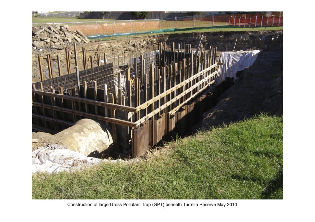
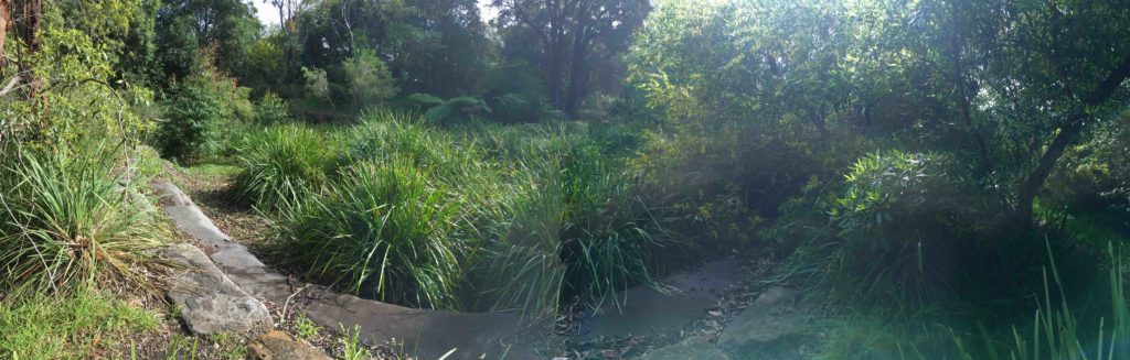
- 2010 Turrella Reserve – Installation of a very large GPT below the parkland to remove rubbish and some silt from a large stormwater catchment before it entered Turrella Creek, which bisects the Reserve.
- 2011 Highcliff Road – Construction of a roadside ‘rain garden’ (a planted swale) at the eastern end of the road to slow, filter, and remove nutrients from stormwater from nearby streets and houses. In 2022, during a major La Nina period the swale collapsed in two places. In 2023 work by Canterbury-Bankstown City began to deal with the resulting damage and loss.
- 2011 Johnston St. – construction of a bio-retention basin that slows down and holds back water flow in low-flow rain events, and removes silt and nutrients from the held-back water.
Other stormwater improvements were also achieved:
- 2009 Fauna St. – Reconstruction of stormwater flow to Wolli Creek through bio-retention swales in an adjacent grassed area. This channelled water into a wetland, previously installed by NPWS that further slowed, filtered and removed some nutrients from the flow.
- 2009 – Canterbury Council installed ‘pit traps’ at a number of entry points to stormwater pipes to catch ‘gross pollutants’ – larger-sized rubbish, such as food and drink containers, cigarette butts, etc – and some sediments.
- 2011 Undercliffe Track – realignment and armouring of initial channel below the rain garden outlet from Highcliff Road. Arranged by WCPS with Sydney Water and their contractors as part of sewer re-lining work through this section of the valley.
- 2018 Paperbark Creek – extensive bushcare work undertaken by WCPS under a two-year grant from the NSW Government’s Environmental Trust. This included temporary re-channelling of the middle section of the creek below Bray Avenue; removal of Willows, Lantana and weed vines; removal of swathes of weeds from the Creek’s banks and floodplain, and the planting of hundreds of sedges from local provenance stock to replace the weeds.
These all made valuable contributions to improving the quality of water reaching Wolli Creek from its northern side, although two significant streams remained untreated at 2023. Other than in Bardwell Creek, no treatment of stormwater existed at June 2023 for inflows from the southern side (Bayside Council).


MONITORING THE VALLEY
WCPS members participate in a number of activities that monitor the valley. These include the following:
Citizen Science
Our volunteers assist with observing, documenting and reporting on nature in the Valley.
- 2007 Bird surveys commenced following the revised, expanded and updated publication of Neil Rankin’s book, Birds of Wolli Valley in 2006
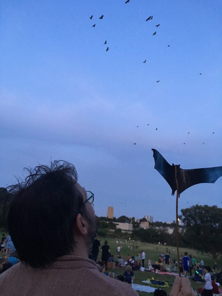
- 2008 Bats – first Grey-headed Flying-fox counts began.
Track monitors
organised reporting to WCPS by members and local residents walking frequently in the valley of issues or interesting things seen began in 2022. This has enabled issues to be picked up quickly and reported to appropriate authorities for their attention or dealt with by volunteers. Such issues include dumping of rubbish, fallen trees, bad behaviour, and problems caused by landowners adjacent to the Wolli Creek Regional Park.
Monitoring Development Activity
Since 2008 Wolli Creek Preservation Society has endeavoured to monitor development applications, approvals, and adherence to conditions of consent where the properties involved are likely to have an impact on Wolli Creek Regional Park, as well as illegal and unauthorised activities on such properties. WCPS has frequently made representations to Bayside and Canterbury-Bankstown Councils and their predecessors regarding its concerns. Examples include major proposals and activities in the Turrella industrial estate and a number of individual residential developments.
AWARENESS AND COMMUNITY ENGAGEMENT
WCPS has involved the community in many events to protect, raise awareness of, and better inform the local community about the valley. These include:
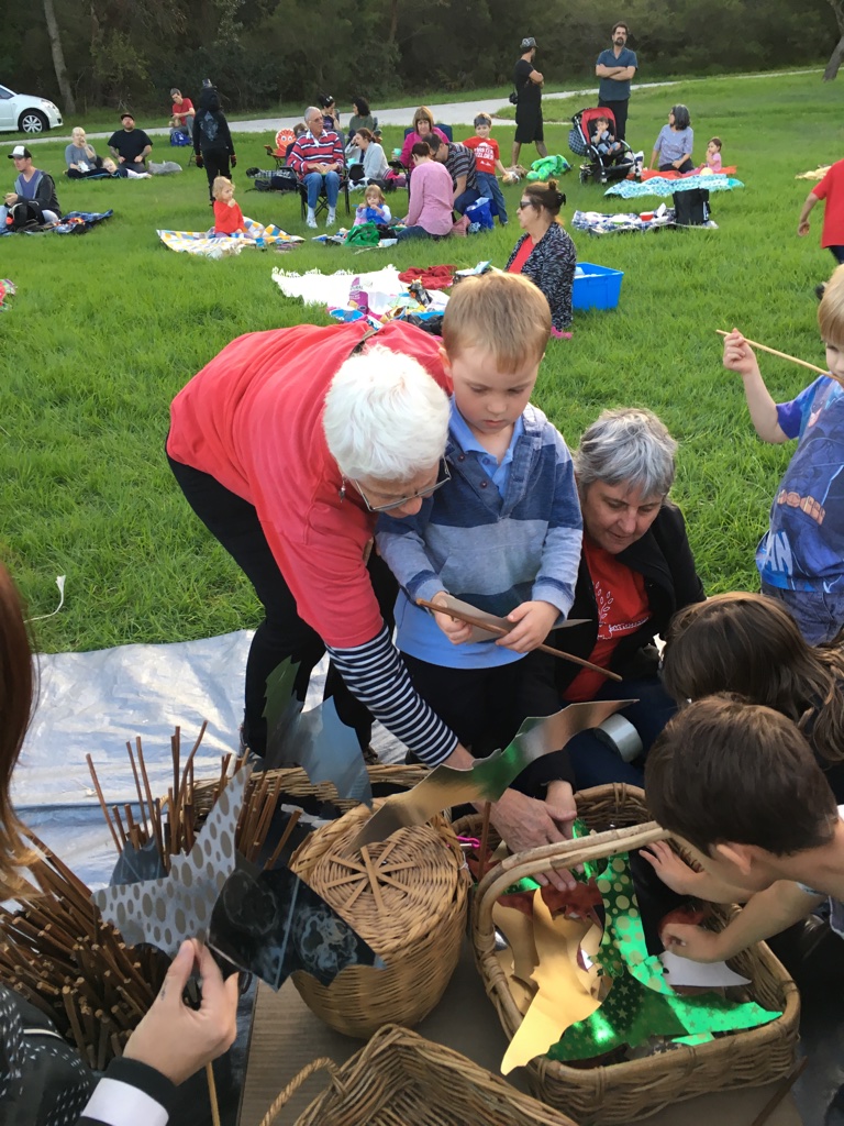
- Bat Watch picnics – commenced in March 2014 at Turrella Reserve and held annually till 2020. In 2019 this event attracted 500 participants.
- Schools program – Neil Rankin Award commenced in 2004. This was made possible by a grant from Danielle Rankin of Dudley, NSW, formerly of Earlwood, to commemorate the life and work of her late husband, Neil Rankin (often known as the ‘Birdman of Wolli Creek’), and her son the late Peter Rankin, herpetologist. This fund has been used for an award for Primary Schools in the area. Given to a school, class or individual in recognition of the excellent work done to foster children’s enjoyment and understanding of the natural world.
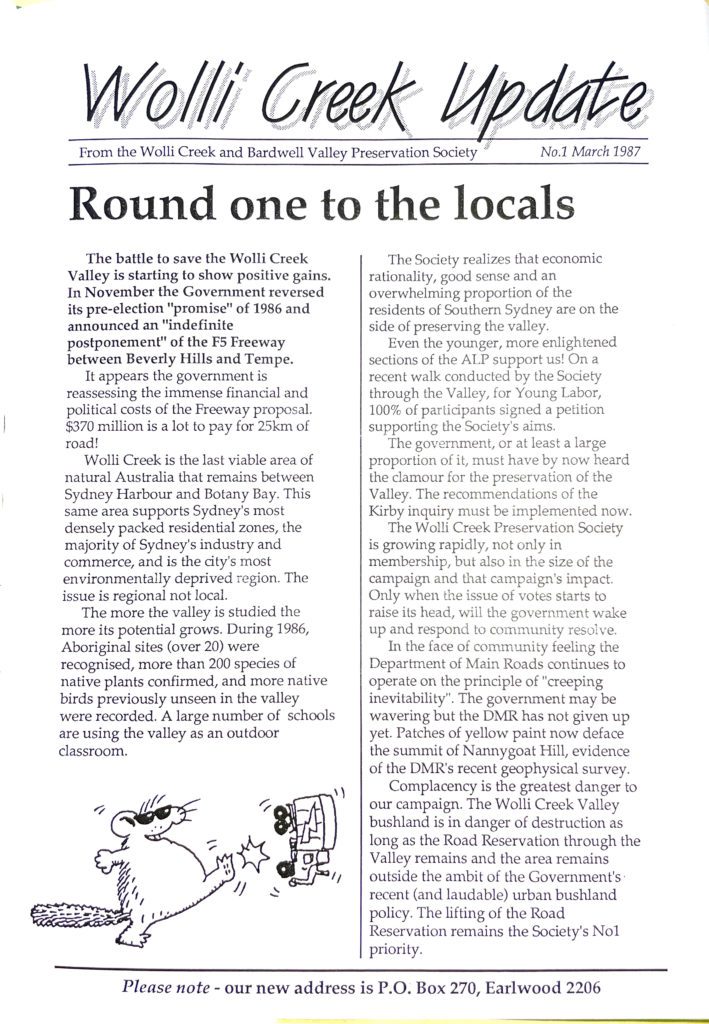
- Wolli Creek Update (newsletter) – First edition March 1987; issued to keep members informed of the activities of WCPS and major issues and campaigns. The 100th edition appeared in June 2023.
- Annual dinners – these commenced in 1988 with David Kirby (of the Kirby Inquiry) being the first guest speaker. This dinner celebrated the victory of saving the bushland when the F5 Freeway reservation was lifted from the main bushland area of the Wolli Creek Valley.
- Social media – Facebook page Protect Wolli Creek Valley was created in August 2010. Instagram and Twitter pages were also set up.
- Interpretive bushwalks (already underway in 1987) and kayak trips (commenced 2004), and occasional talks – these activities have introduced many people to the Wolli Creek Valley and helped them learn more about the bushland, creek and wildlife and the various threats faced over many years.
- Plantings – these have been held at various sites along the Valley and are a great way for members to come together and extend the bushland. Usually conducted when grant money has been obtained.
- Campaign events – these have included rallies and events to protest plans that will impact the Wolli Creek Valley.
- Other community days and events – such as community clean-up days, public talks, National Tree days and other picnics that aimed to engage the community with WCPS and its work.